Serving Southern Jefferson County in the Great State of Montana

Healthy April 1 Snowpack Results in Near to Slightly Above Average Streamflow Forecasts

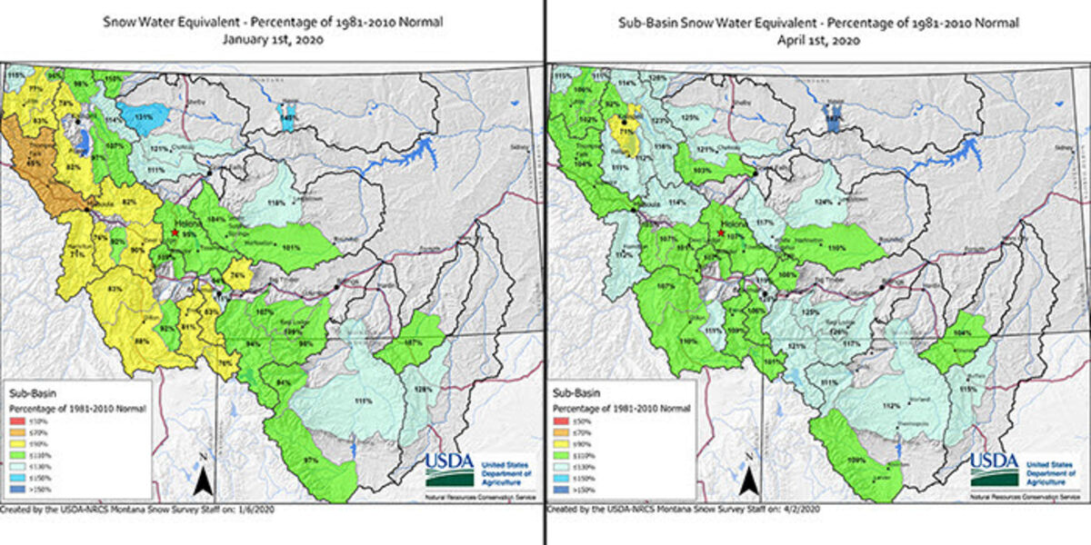
BOZEMAN – On April 1, many low- and mid-elevation mountain snowpack monitoring locations are typically approaching their seasonal peak snowpack for the year, giving hydrologists good insight into what snowpack will yield with regards to water supply during spring and summer.

"The news is as good as we get closer to runoff season this year, aside from one small lower elevation range west of Flathead Lake, most mountain ranges in Montana have a snowpack that is near to above normal for this date, even though March snow totals were below normal in some regions," said Lucas Zukiewicz, USDA Natural Resources Conservation Service water supply specialist for Montana.

As a whole, streamflow forecasts across the state are near to slightly above average for the April 1 through July 31 period. "Water users are encouraged to look at this month's water supply outlook report for forecasts in their region of interest, as forecasts can vary widely within a particular river basin. A few rivers west of the Divide have forecasts that are slightly below average due to the lack of late fall and early winter precipitation, even though snowpack is near normal for this date," said Zukiewicz. This situation is not present in all river basins within the state, but it should be noted that it has impacted runoff forecasts where it is occurring.

"As we progress further into spring, we should continue to accumulate snowpack in the high elevations in the mountains across the state, and May 1 forecasts will use a more accurate snapshot into our peak snowpack, and what that should yield with regards to our overall runoff volumes this year," according to Zukiewicz.

Monthly Water Supply Outlook Reports can be found at the website below after the fifth business day of the month: https://www.nrcs.usda.gov/wps/portal/nrcs/mt/snow/.


Reader Comments(0)